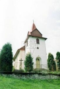
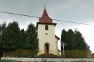
The village Zálesie (in past Gibeľ) is a small village situated at the Zálesie Creek in the Zamagurie region.
It was founded as a result of rural colonisation on the estates of the Niedzica castle in the 16-th century. People worked mostly as farmers and woodcutters. In 1794 they decided to write a complaint in the Slovak language to the local lords - describing the injustice they faced. Between 1890 and 1910 many people moved out to the American continent. Population still falls down in number.
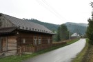
Rustic family houses in the village were built next to each other creating a long chain of houses with shingle roofs and originally designed shields.