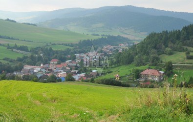
Veľká Franková situated in the valley of Frankovský potok (Frankovský Creek) in the Zamagurie region. It was founded during the first phase of colonisation (allowed by the Gorgey family) in the 13-th century. During sc. walachian colonisation in the 16-th century it was re-colonised and till the 9-th century it was a vassal village of the Red Monastery.
Locals were first of all shepherds, but they also worked in a sawmill and in a mill. A lot of people moved out of Veľká Franková between 1890 and 1910. Today most of them work as farmers, in winter as woodcutters, masons or builders (also outside of the village).
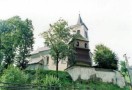
You can find there a Roman-Catholic church from the 18-th century and a wooden belfry.