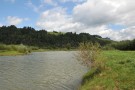
Spišská Stará Ves is a small town situated in the valley of Rieka. It is an old centre of the Zamagurie region. It is probable that village was founded already before the Tatar invasion. At the beginning of the 14-th century it was colonised again with the help of the lords from Brezovica. From 1337 to the 19-th century it was a property of the Red Monastery and Cartesians from Lechnica.
Many negotiations between the neighbouring countries took place in the town in the Middle Ages. For instance Ungarian monarch Žigmund and a Polish king Vladislav met here in 1423 and Matej Korvín and Kazimír Jagelovský in 1474. In the 15-th century it was occupied by Husits (followers of Ján Hus) for a short time.
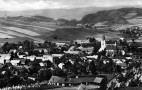
Thanks to its suitable location (close to important trade routes) and rush business connections it developed very quickly. It gained some royal privileges and became a seat of the local administration (till 1960). After 14 local villages were given to Poland (shortly before the World War II.) it started to decline.
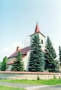
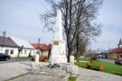
In the town there is a gothic Roman.Catholic church from the 14-th century, rebuilt in the 18-th century in the baroque style, and three road chapels. In the centre you can notice a memorial devoted to the victims of the World War II.